
Get Involved in this Historic Process!
We are nearing the finish line for Goleta’s historic district mapping process! Public participation is the most important part of this process. You have until January 6th to draw and submit a map showing what you think the City’s first-ever district boundaries should be.
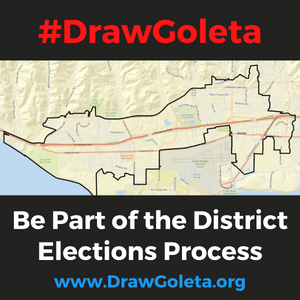
Beginning in November 2022, the City will be divided into four districts, and voters in each district will elect a City Councilmember who lives in their own district. The Mayor will continue to be elected by voters across Goleta.
If you need help drawing your map, watch our “How to Draw a Map” video tutorial. If you prefer to submit your ideas using a paper map, you can pick one up from Goleta City Hall or the Goleta Valley Library during hours of operation.
Please note, if you submitted a map before the mapping tools were updated with the official Census 2020 population data on October 19, 2021, your map needs to be resubmitted. Click here for tips on how to re-draw your map. The tips are also useful for anyone creating a map online.
The Public Engagement Commission (PEC) will review the submitted maps at its January 26, 2022, meeting and make recommendations to the City Council. Hear directly from the PEC on the significance of district elections by watching this video.
For more information go to www.DrawGoleta.org. For additional questions or assistance, please contact cityclerkgroup@cityofgoleta.org or call 805-961-7505. Thank you for your interest and participation in shaping the future of Goleta.