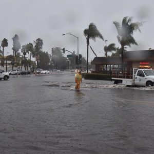
The Santa Barbara County Water Agency (SBCWA) will hold a meeting to receive public comment on updated flood insurance rate maps from the Federal Emergency Management Agency (FEMA). This meeting will help residents and local business owners learn more about the National Flood Insurance Program (NFIP) and to provide input for consideration before the maps are finalized. The new maps are preliminary and Santa Barbara County officials encourage residents and business owners to review the proposed flood insurance rate maps to learn about local flood risks, potential future flood insurance requirements, and identify any concerns or questions about the information provided. The meeting will be held on October 26, 2017 from 6:00 – 8:00 p.m. at the Santa Barbara County Administrative Building, 105 E. Anapamu St. For more information on the meeting and this process, contact Jon Frye at jfrye@cosbpw.net. Preliminary copies of the revised Flood Insurance Rate Map (FIRM) and Flood Insurance Study (FIS) can be found at http://arcg.is/2g2RPSj.
Photo by Giana Magnioli, Noozhawk

